GPS Photo Viewer (use Google Map)
Easy to Check/Edit photo's latitude and longitude.
Click here 
Download from
1. Google Play:
https://play.google.com/store/apps/details?id=com.jkfantasy.photopoi
2. Samsung Apps Store.
http://apps.samsung.com/venus/topApps/topAppsDetail.as?productId=000000555233
GPS Photo Viewer
Function :
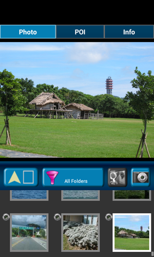
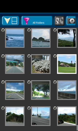
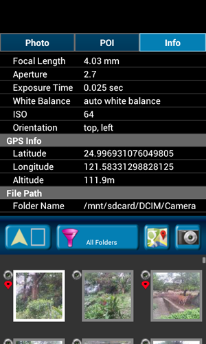
1. Quickly check photo's GPS information.
2. Quickly check photo's camera information.
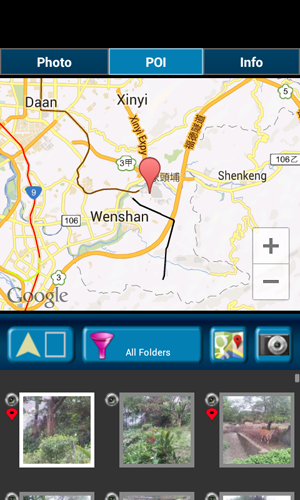
3. Navigate GPS-POI in google map.
4. Launch to "google map application" with photo's GPS location.
Purpose :
1. You can copy your GPS photos to your friends, and then they can go there if they are interest.
2. Want to know where to take the picture.
3. Want to know the "focal length", "aperture", "ISO" value in the photo.
Others :
1. It could be slow at first time loading image. After decoding finish, it will be fast.
2. Remember turn on GPS funtion when you take a picture. And the photo will contail GPS info.

Weather Map (use Google Map)
Check weather from Google Map. Nothing is more simple than this.
Click here
Download from
1. Google Play:
https://play.google.com/store/apps/details?id=com.jkfantasy.map.weathermap
Weather Map (Google Map)
Check weather from Google Map
Nothing is more simple than this.
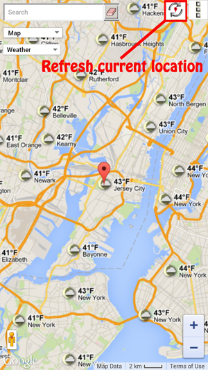
When APP starts, it will get your current location. If found, the location will set to map center and you can check the neighborhood weather.
Please enable your location service. ( Setings / Location services ) Then APP can found where you are.
Main function :
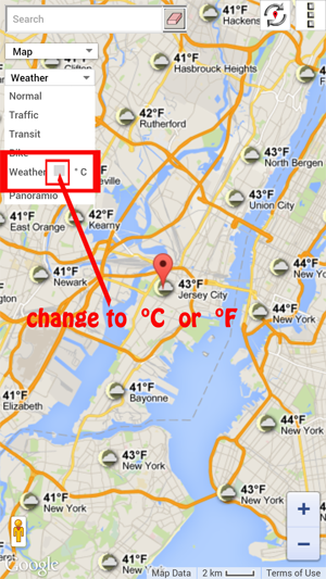
a) support traffic/weather/panoramio layer.
b) support street view.
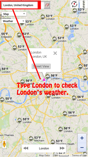
c) support place search.
Others :
Please check the screenshot for detail explanation.